Naruko
470 m1,542 ft
Mountain · Japan
Naruko is a stratovolcano located in Ōsaki, Miyagi Prefecture, Japan. The volcano consists of a 7 km wide caldera with several lava domes. The summit of the 470 m high Mt. Kurumigatake is one of the four lava domes located in the center of the caldera.
From Wikipedia, CC BY-SA · Read the article
 See it in 3D
Facts
- What it is
- Mountain
- Height above sea level
- 470 m (1,542 ft)
- Country
- Japan
- Coordinates
- 38.733°N 140.732°E
- Volcano number
- 283200 at the Global Volcanism Program
- Source
- Wikidata, CC0
Naruko (volcano)
Stratovolcano on the island of Honshu, Japan
Naruko is a stratovolcano located in Ōsaki, Miyagi Prefecture, Japan. The volcano consists of a 7 km wide caldera with several lava domes. The summit of the 470 m high Mt. Kurumigatake is one of the four lava domes located in the center of the caldera. The volcano is well known because of its relationship to the Naruko Hot Springs Villages.
From Wikipedia, CC BY-SA · Read the article
Peaks near Naruko
- Mount Kurikoma1,628 m · 26 km awayOn the map
- Funagata volcano1,500 m · 32 km awayOn the map
- Kinkeizan99 m · 44 km awayOn the map
- Mount Yakeishi1,548 m · 49 km awayOn the map
- Mount Hiyori3 m · 58 km awayOn the map
- Mount Hanabuchi985 m · 5.4 km awayOn the map
- Mount Kamuro1,262 m · 15 km awayOn the map
- 前森高原Mountain · 17 km awayOn the map
- Mount Yakurai553 m · 18 km awayOn the map
- Mount Torage1,433 m · 21 km awayOn the map
Highest mountains in Japan
- Mount Fuji3,777 mOn the map
- Mount Kita3,193 mOn the map
- Hotaka Mountains3,190 mOn the map
- Ainodake3,189 mOn the map
- Mount Yari3,180 mOn the map
- Mount Warusawa3,141 mOn the map
- Mount Akaishi3,120 mOn the map
- Mount Ontake3,067 mOn the map
- Mount Shiomi3,047 mOn the map
- Mount Senjō3,033 mOn the map
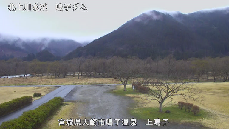
Webcams near Naruko



History around Naruko
- Hōreki famine1755
- Kasai Oosaki uprising1590
- Zenkunen War1051