Mountains in Japan
Mount Kurikoma
1,628 m5,341 ft
Volcano · Ou Mountains · Japan
At the summit · forecast for 10:00 AM
5 °CLight rain · wind 6 km/h from the SW
 See it in 3D
Weather at the summit of Mount Kurikoma, 1,628 m
- 10:00 AM5 °CSW 6 km/h0.1 mm
- 1:00 PM8 °CW 13 km/h–
- 4:00 PM6 °CW 15 km/h1.2 mm
- 7:00 PM4 °CW 15 km/h2.4 mm
- 10:00 PM1 °CNW 27 km/h1.3 mm
- 1:00 AM-1 °CNW 24 km/h2.8 mm
- 4:00 AM-3 °CNW 32 km/h1.3 mm
- 7:00 AM-4 °CW 27 km/h1.5 mm
| Day | Sky | High / low | Rain | Wind up to |
|---|---|---|---|---|
| Today | Cloudy | 8 °C / -1 °C | 4.3 mm | 27 km/h |
| Wed, Oct 28 | Snow | -1 °C / -5 °C | 9 mm | 32 km/h |
| Thu, Oct 29 | Cloudy | 4 °C / -5 °C | – | 23 km/h |
| Fri, Oct 30 | Partly cloudy | 7 °C / 1 °C | 2.9 mm | 5 km/h |
| Sat, Oct 31 | Sleet | 5 °C / 0 °C | 11.9 mm | 26 km/h |
| Sun, Nov 1 | Cloudy | 1 °C / -3 °C | 1.5 mm | 28 km/h |
| Mon, Nov 2 | Rain | 4 °C / -1 °C | 8.6 mm | 18 km/h |
Forecast by MET Norway (CC BY 4.0), updated 08:20 AM GMT+9. Times are local.
Facts
- What it is
- Volcano
- Height above sea level
- 1,628 m (5,341 ft)
- Range
- Ou Mountains
- Country
- Japan
- Coordinates
- 38.961°N 140.789°E
- Volcano number
- 283210 at the Global Volcanism Program
- Source
- Wikidata, CC0
8 recorded eruptions
Peaks near Mount Kurikoma
- Mount Yakeishi1,548 m · 23 km awayOn the map
- Naruko470 m · 26 km awayOn the map
- Kinkeizan99 m · 28 km awayOn the map
- Funagata volcano1,500 m · 58 km awayOn the map
- 高松岳1,348 m · 16 km awayOn the map
- Mount Torage1,433 m · 16 km awayOn the map
- Hanganmori150 m · 18 km awayOn the map
- Mount Kamuro1,262 m · 24 km awayOn the map
- Mount Hanabuchi985 m · 24 km awayOn the map
- Mount Kamuro1,365 m · 27 km awayOn the map
Highest in the Ou Mountains
- Mount Iwate2,038 mOn the map
- Mount Azuma2,035 mOn the map
- Mount Nasu1,917 mOn the map
- Mount Zaō1,841 mOn the map
- Mount Bandai1,819 mOn the map
- Mount Adatara1,728 mOn the map
- Akita-Komagatake1,637 mOn the map
- Mount Kurikoma1,628 mOn the map
- Mount Iwaki1,625 mOn the map
Highest mountains in Japan
- Mount Fuji3,777 mOn the map
- Mount Kita3,193 mOn the map
- Hotaka Mountains3,190 mOn the map
- Ainodake3,189 mOn the map
- Mount Yari3,180 mOn the map
- Mount Warusawa3,141 mOn the map
- Mount Akaishi3,120 mOn the map
- Mount Ontake3,067 mOn the map
- Mount Shiomi3,047 mOn the map
- Mount Senjō3,033 mOn the map
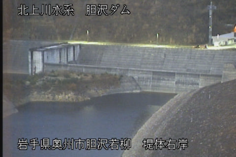
Webcams near Mount Kurikoma

History around Mount Kurikoma
Towns near Mount Kurikoma
- Kurihara30 km away
- Ichinoseki30 km away
- Yuzawa34 km away
- Mizusawa35 km away
- Ōshū38 km away
- Kanegasaki39 km away