Akita-Komagatake
1,637 m5,372 ft
Volcano · Ou Mountains · Japan
Akita-Komagatake is an active stratovolcano located 10 km east of Tazawa Lake, near the border between Akita and Iwate prefectures on Honshu Island. The volcano last erupted from 18 September 1970 to 25 January 1971.
From Wikipedia, CC BY-SA · Read the article
At the summit · forecast for 6:00 PM
-6 °CCloudy · wind 17 km/h from the W
 See it in 3D
Weather at the summit of Akita-Komagatake, 1,637 m
- 6:00 PM-6 °CW 17 km/h–
- 9:00 PM-6 °CNW 18 km/h–
- 12:00 AM-5 °CW 21 km/h–
- 3:00 AM-4 °CW 18 km/h–
- 6:00 AM-5 °CNW 8 km/h–
- 9:00 AM-1 °CW 4 km/h–
- 12:00 PM2 °CS 12 km/h–
- 3:00 PM2 °CS 15 km/h–
| Day | Sky | High / low | Rain | Wind up to |
|---|---|---|---|---|
| Thu, Oct 29 | Cloudy | 2 °C / -5 °C | – | 21 km/h |
| Fri, Oct 30 | Cloudy | 7 °C / 0 °C | 4.4 mm | 17 km/h |
| Sat, Oct 31 | Partly cloudy | 4 °C / -3 °C | 11.5 mm | 21 km/h |
| Sun, Nov 1 | Cloudy | -2 °C / -4 °C | 0.5 mm | 27 km/h |
| Mon, Nov 2 | Rain | 2 °C / -3 °C | 23.7 mm | 9 km/h |
| Tue, Nov 3 | Partly cloudy | 0 °C / -4 °C | 1.2 mm | 21 km/h |
| Wed, Nov 4 | Cloudy | -1 °C / -8 °C | 3.3 mm | 23 km/h |
Forecast by MET Norway (CC BY 4.0), updated 05:20 PM GMT+9. Times are local.
Facts
- What it is
- Volcano
- Height above sea level
- 1,637 m (5,372 ft)
- Range
- Ou Mountains
- Country
- Japan
- Coordinates
- 39.761°N 140.804°E
- Volcano number
- 283230 at the Global Volcanism Program
- Source
- Wikidata, CC0
Mount Akita-Komagatake
Active volcano on the island of Honshu in Japan
Akita-Komagatake is an active stratovolcano located 10 km east of Tazawa Lake, near the border between Akita and Iwate prefectures on Honshu Island. The volcano last erupted from 18 September 1970 to 25 January 1971. It is the highest mountain in Akita Prefecture and the second highest in Towada-Hachimantai National Park.
From Wikipedia, CC BY-SA · Read the article
18 recorded eruptions
- Eruption in 1970
- Eruption in 1932
- Eruption in 1902
- Eruption in 1890
- Eruption in 1100
- Eruption in 807
- Eruption in 400
- Eruption in 50 BCE
- Eruption in 200 BCE
- Eruption in 350 BCE
- Eruption in 1,450 BCE
- Eruption in 5,950 BCE
The latest 12 of 18, from the Smithsonian’s Global Volcanism Program through History.
Peaks near Akita-Komagatake
- Mount Iwate2,038 m · 20 km awayOn the map
- Hachimantai1,613 m · 22 km awayOn the map
- Akita-Yakeyama1,366 m · 23 km awayOn the map
- Mount Moriyoshi1,454 m · 33 km awayOn the map
- Mount Himekami1,124 m · 39 km awayOn the map
- Mount Nanashigure1,063 m · 43 km awayOn the map
- Babamedake1,037 m · 45 km awayOn the map
- Mount Nyuto1,478 m · 5.8 km awayOn the map
- Mount Mitsuishi1,466 m · 13 km awayOn the map
- Mount Ōbuka1,541 m · 15 km awayOn the map
Highest in the Ou Mountains
- Mount Iwate2,038 mOn the map
- Mount Azuma2,035 mOn the map
- Mount Nasu1,917 mOn the map
- Mount Zaō1,841 mOn the map
- Mount Bandai1,819 mOn the map
- Mount Adatara1,728 mOn the map
- Akita-Komagatake1,637 mOn the map
- Mount Kurikoma1,628 mOn the map
- Mount Iwaki1,625 mOn the map
Highest mountains in Japan
- Mount Fuji3,777 mOn the map
- Mount Kita3,193 mOn the map
- Hotaka Mountains3,190 mOn the map
- Ainodake3,189 mOn the map
- Mount Yari3,180 mOn the map
- Mount Warusawa3,141 mOn the map
- Mount Akaishi3,120 mOn the map
- Mount Ontake3,067 mOn the map
- Mount Shiomi3,047 mOn the map
- Mount Senjō3,033 mOn the map
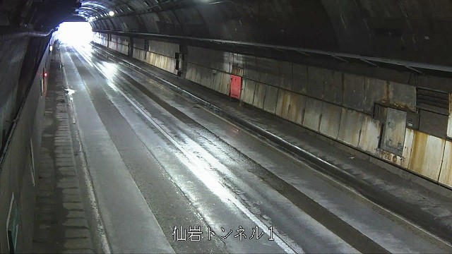
Webcams near Akita-Komagatake



History around Akita-Komagatake
Towns near Akita-Komagatake
- Semboku7.5 km away
- Shizukuishi17 km away
- Takizawa29 km away
- Morioka30 km away
- Hachimantai32 km away
- Yahaba34 km away