Mountains in Austria
Plattenspitze
2,294 m7,526 ft
Mountain · Schladming Tauern · Austria
The Plattenspitze or Plattenspitz is a mountain, 2,294 metres high above the village of Obertauern and on the territory of the municipality of Tweng, Austria. Its summit lies within the Schladming Tauern range and is usually traversed by climbers making for the Gamskarlspitze (2,411 m) to the south.
From Wikipedia, CC BY-SA · Read the article
At the summit · forecast for 10:00 AM
-2 °CCloudy · wind 8 km/h from the NW
 See it in 3D
Weather at the summit of Plattenspitze, 2,294 m
- 10:00 AM-2 °CNW 8 km/h–
- 1:00 PM-1 °CNW 7 km/h–
- 4:00 PM-1 °CN 7 km/h–
- 7:00 PM-2 °CN 6 km/h–
- 10:00 PM-3 °CN 5 km/h–
- 1:00 AM-3 °CNE 5 km/h–
- 4:00 AM-4 °CE 5 km/h–
- 7:00 AM-4 °CNE 6 km/h–
| Day | Sky | High / low | Rain | Wind up to |
|---|---|---|---|---|
| Today | Cloudy | -1 °C / -3 °C | – | 8 km/h |
| Fri, Oct 30 | Clear | 2 °C / -6 °C | – | 10 km/h |
| Sat, Oct 31 | Partly cloudy | -1 °C / -7 °C | 1.9 mm | 18 km/h |
| Sun, Nov 1 | Snow | -5 °C / -7 °C | 8.2 mm | 12 km/h |
| Mon, Nov 2 | Light snow | -5 °C / -8 °C | 3 mm | 8 km/h |
| Tue, Nov 3 | Cloudy | -6 °C / -8 °C | 1.2 mm | 9 km/h |
| Wed, Nov 4 | Clear | -3 °C / -10 °C | – | 4 km/h |
Forecast by MET Norway (CC BY 4.0), updated 09:20 AM GMT+1. Times are local.
Facts
- What it is
- Mountain
- Height above sea level
- 2,294 m (7,526 ft)
- Isolation
- 0.4 km to higher ground
- Range
- Schladming Tauern
- Country
- Austria
- Coordinates
- 47.256°N 13.579°E
- Source
- Wikidata, CC0
Peaks near Plattenspitze
- Hochgolling2,862 m · 14 km awayOn the map
- Weißeck2,711 m · 17 km awayOn the map
- Planai1,906 m · 17 km awayOn the map
- Hauser Kaibling2,015 m · 20 km awayOn the map
- Hochwildstelle2,747 m · 21 km awayOn the map
- Preber2,740 m · 22 km awayOn the map
- Hoher Dachstein2,995 m · 24 km awayOn the map
- Grosser Hafner3,076 m · 25 km awayOn the map
- Gjaidstein2,794 m · 25 km awayOn the map
- Bischofsmütze2,458 m · 27 km awayOn the map
Highest in the Schladming Tauern
- Hochgolling2,862 mOn the map
- Hochwildstelle2,747 mOn the map
- Kasereck2,740 mOn the map
- Waldhorn2,702 mOn the map
- Greifenberg2,618 mOn the map
- Großer Knallstein2,599 mOn the map
- Rupprechtseck2,591 mOn the map
- Süßleiteck2,507 mOn the map
- Plattenspitze2,294 mOn the map
Highest mountains in Austria
- Grossglockner3,798 mOn the map
- Wildspitze3,768 mOn the map
- Weißkugel3,738 mOn the map
- Großvenediger3,657 mOn the map
- Hintere Schwärze3,624 mOn the map
- Großes Wiesbachhorn3,564 mOn the map
- Ramolkogel3,549 mOn the map
- Schalfkogel3,537 mOn the map
- Watzespitze3,532 mOn the map
- Fineilspitze3,514 mOn the map
Webcams near Plattenspitze

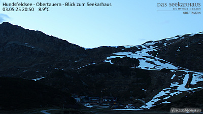

History around Plattenspitze
Towns near Plattenspitze
- Saalfelden am Steinernen Meer58 km away
- Salzburg73 km away
- Bad Reichenhall74 km away
- Villach75 km away
- Freilassing79 km away