Mountains in Nepal
Pokalde
5,806 m19,049 ft
Mountain · Himalayas · Nepal
Pokalde Peak is a mountain peak of Nepal situated 12 km southwest of Mount Everest. Pokalde Peak is one of the shortest and easiest trekking peaks in the Everest Region. The majority of the 650 metres (2,130 ft) climb from base camp requires little more than walking with short sections of scrambling up rock.
From Wikipedia, CC BY-SA · Read the article
At the summit · forecast for 4:45 AM
-17 °CClear · wind 7 km/h from the NE
 See it in 3D
Weather at the summit of Pokalde, 5,806 m
- 4:45 AM-17 °CNE 7 km/h–
- 7:45 AM-11 °CNE 6 km/h–
- 10:45 AM-5 °CSE 7 km/h–
- 1:45 PM-5 °CS 9 km/h–
- 4:45 PM-9 °CE 3 km/h–
- 7:45 PM-13 °CNE 6 km/h–
- 10:45 PM-13 °CNE 5 km/h–
- 1:45 AM-14 °CNE 6 km/h–
| Day | Sky | High / low | Rain | Wind up to |
|---|---|---|---|---|
| Today | Clear | -5 °C / -17 °C | – | 9 km/h |
| Wed, Oct 28 | Cloudy | -4 °C / -15 °C | – | 9 km/h |
| Thu, Oct 29 | Light snow | -5 °C / -10 °C | 19.1 mm | 9 km/h |
| Fri, Oct 30 | Heavy snow | -7 °C / -8 °C | 82.3 mm | 4 km/h |
| Sat, Oct 31 | Cloudy | -5 °C / -15 °C | 0.5 mm | 6 km/h |
| Sun, Nov 1 | Clear | -5 °C / -16 °C | 0.3 mm | 8 km/h |
| Mon, Nov 2 | Mostly clear | -7 °C / -22 °C | 0.4 mm | 9 km/h |
Forecast by MET Norway (CC BY 4.0), updated 01:01 AM GMT+5:45. Times are local.
Facts
- What it is
- Mountain
- Height above sea level
- 5,806 m (19,049 ft)
- Prominence
- 270 m (886 ft)
- Range
- Himalayas
- Country
- Nepal
- Coordinates
- 27.925°N 86.833°E
- Source
- Wikidata, CC0
Peaks near Pokalde
- Lobuche6,145 m · 5.7 km awayOn the map
- Taboche6,501 m · 6.1 km awayOn the map
- Cholatse6,440 m · 6.6 km awayOn the map
- Nuptse7,861 m · 7.2 km awayOn the map
- Ama Dablam6,814 m · 7.6 km awayOn the map
- Kala Patthar5,645 m · 7.9 km awayOn the map
- Hillary Peak7,681 m · 8.4 km awayOn the map
- Nirekha6,169 m · 9.1 km awayOn the map
- Ombigaichan6,340 m · 9.4 km awayOn the map
- Imja Tse6,189 m · 9.9 km awayOn the map
Highest in the Himalayas
- Kanchenjunga8,586 mOn the map
- Dhaulagiri8,167 mOn the map
- Nanga Parbat8,126 mOn the map
- Nanda Devi7,816 mOn the map
- Jannu7,711 mOn the map
- Gurla Mandhata7,694 mOn the map
- Silberzacken7,597 mOn the map
- Gangkhar Puensum7,570 mOn the map
- Pokalde5,806 mOn the map
Highest mountains in Nepal
- Mount Everest8,849 mOn the map
- Kanchenjunga8,586 mOn the map
- Lhotse8,516 mOn the map
- Makalu8,485 mOn the map
- Cho Oyu8,188 mOn the map
- Dhaulagiri8,167 mOn the map
- Manaslu8,163 mOn the map
- Annapurna I8,091 mOn the map
- Gyachung Kang7,952 mOn the map
- Annapurna II7,937 mOn the map
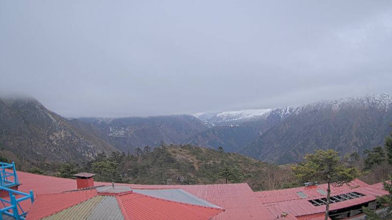
Webcams near Pokalde
History around Pokalde
Towns near Pokalde
- Khā̃dbāri̇̄71 km away