Mountains in United States
Ring Mountain
603 ft184 m
Mountain · United States
Ring Mountain is an elevated landform on the Tiburon Peninsula in Marin County, California. This mountain was named for George E. Ring, who served as a Marin County Supervisor from 1895 to 1903.
From Wikipedia, CC BY-SA · Read the article
At the summit · forecast for 1:00 PM
61 °FPartly cloudy · wind 11 mph from the S
 See it in 3D
Weather at the summit of Ring Mountain, 603 ft
- 1:00 PM61 °FS 11 mph–
- 4:00 PM63 °FW 19 mph–
- 7:00 PM57 °FNW 16 mph–
- 10:00 PM54 °FNW 11 mph–
- 1:00 AM51 °FN 6 mph–
- 4:00 AM48 °FN 5 mph–
- 7:00 AM45 °FN 4 mph–
- 10:00 AM52 °FNE 3 mph–
| Day | Sky | High / low | Rain | Wind up to |
|---|---|---|---|---|
| Wed, Oct 28 | Fog | 63 °F / 45 °F | – | 11 mph |
| Thu, Oct 29 | Cloudy | 62 °F / 51 °F | – | 10 mph |
| Fri, Oct 30 | Clear | 60 °F / 52 °F | – | 10 mph |
| Sat, Oct 31 | Mostly clear | 59 °F / 50 °F | – | 7 mph |
| Sun, Nov 1 | Clear | 64 °F / 49 °F | – | 5 mph |
| Mon, Nov 2 | Cloudy | 67 °F / 50 °F | – | 4 mph |
| Tue, Nov 3 | Cloudy | 67 °F / 54 °F | – | 6 mph |
Forecast by MET Norway (CC BY 4.0), updated 12:17 PM PDT. Times are local.
Facts
- What it is
- Mountain
- Height above sea level
- 603 ft (184 m)
- Prominence
- 402 ft (123 m)
- Country
- United States
- Coordinates
- 37.910°N 122.486°W
- Source
- Wikidata, CC0
Peaks near Ring Mountain
- Mount Tamalpais2,572 ft · 8.4 km awayOn the map
- Telegraph Hill299 ft · 14 km awayOn the map
- Nob Hill371 ft · 14 km awayOn the map
- Lone Mountain421 ft · 15 km awayOn the map
- Strawberry Hill404 ft · 16 km awayOn the map
- Albany Hill310 ft · 16 km awayOn the map
- Mount Olympus561 ft · 17 km awayOn the map
- Mount Sutro912 ft · 17 km awayOn the map
- William Rust Summit1,004 ft · 17 km awayOn the map
- Twin Peaks925 ft · 18 km awayOn the map
Highest mountains in United States
- Denali20,308 ftOn the map
- Mount Saint Elias18,009 ftOn the map
- Mount Foraker17,402 ftOn the map
- Mount Bona16,535 ftOn the map
- Mount Blackburn16,390 ftOn the map
- Mount Sanford16,237 ftOn the map
- Mount Vancouver15,787 ftOn the map
- Mount Churchill15,636 ftOn the map
- Mount Fairweather15,325 ftOn the map
- Mount Hubbard14,951 ftOn the map
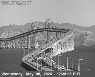
Webcams near Ring Mountain



History around Ring Mountain
- Treaty of San Francisco1951
- The United Nations Charter is signed in San Francisco1945
- ANZUS1951
- Speaker Pelosi's husband Paul is attacked during an early morning break-in at the couple's San Francisco residence2022
- UPS shooting in San Francisco2017
- 2017 Berkeley protests2017
- 101 California Street shooting1993
- White Night riots1979
Towns near Ring Mountain
- Corte Madera3.1 km away
- Tiburon3.3 km away
- Belvedere4.2 km away
- Mill Valley4.9 km away
- Larkspur5.2 km away
- Sausalito5.7 km away