Mountains in Germany
Setzberg
1,706 m5,597 ft
Mountain · Tegernsee Mountains · Germany
Der Setzberg ist ein 1706 m ü. NHN hoher Berg im Mangfallgebirge. Der Berg ist als einfache Bergwanderung von Sutten oder von Rottach-Egern über das Wallberghaus zu erreichen. Es gibt Übergänge zu Wallberg und Risserkogel.
From German Wikipedia, CC BY-SA · Read the article
 See it in 3D
Facts
- What it is
- Mountain
- Height above sea level
- 1,706 m (5,597 ft)
- Range
- Tegernsee Mountains
- Country
- Germany
- Coordinates
- 47.651°N 11.785°E
- Source
- Wikidata, CC0
Peaks near Setzberg
- Wallberg1,722 m · 1.9 km awayOn the map
- Aiplspitz1,759 m · 11 km awayOn the map
- Rotwand1,884 m · 11 km awayOn the map
- Wendelstein1,838 m · 18 km awayOn the map
- Hochiss2,299 m · 21 km awayOn the map
- Benediktenwand1,801 m · 24 km awayOn the map
- Mondscheinspitze2,106 m · 24 km awayOn the map
- Sonnjoch2,457 m · 30 km awayOn the map
- Jochberg1,565 m · 31 km awayOn the map
- Lamsenspitze2,508 m · 33 km awayOn the map
Highest in the Tegernsee Mountains
- Schinder1,808 mOn the map
- Wallberg1,722 mOn the map
- Setzberg1,706 mOn the map
- Roß- und Buchstein1,701 mOn the map
- Hirschberg1,668 mOn the map
- Schattlahnerkopf1,629 mOn the map
- Lahnerkopf1,621 mOn the map
- Schönberg1,620 mOn the map
- Kampen1,607 mOn the map
Highest mountains in Germany
- Zugspitze2,962 mOn the map
- Hochwanner2,744 mOn the map
- Dreitorspitze2,682 mOn the map
- Hochkalter2,607 mOn the map
- Biberkopf2,599 mOn the map
- Großer Hundstod2,594 mOn the map
- Hochvogel2,592 mOn the map
- Östliche Karwendelspitze2,538 mOn the map
- Hocheisspitze2,523 mOn the map
- Hoher Göll2,522 mOn the map
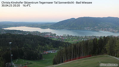
Webcams near Setzberg


History around Setzberg
Towns near Setzberg
- Bad Tölz21 km away
- Holzkirchen26 km away
- Bruckmühl27 km away
- Bad Aibling29 km away
- Kolbermoor31 km away
- Geretsried32 km away