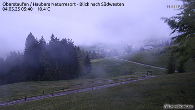
Mountains in Germany
Thaler Höhe
1,167 m3,829 ft
Mountain · Bavarian Alpine Foreland · Germany
Die Thaler Höhe ist ein 1167 m ü. NHN hoher Nebengipfel der Salmaser Höhe in den Allgäuer Alpen oder wahlweise im Bayerischen Alpenvorland, da die beiden Naturräume nicht einheitlich voneinander abgegrenzt werden. Sie liegt im Landkreis Oberallgäu in der Gemarkung der Gemeinde Missen-Wilhams.
From German Wikipedia, CC BY-SA · Read the article
At the summit · forecast for 4:00 AM
6 °CPartly cloudy · wind 13 km/h from the SW
 See it in 3D
Weather at the summit of Thaler Höhe, 1,167 m
- 4:00 AM6 °CSW 13 km/h–
- 7:00 AM7 °CSW 12 km/h1 mm
- 10:00 AM7 °CW 12 km/h1.2 mm
- 1:00 PM6 °CNW 9 km/h0.4 mm
- 4:00 PM6 °CNW 5 km/h–
- 7:00 PM5 °CN 4 km/h–
- 10:00 PM4 °CNE 10 km/h–
- 1:00 AM3 °CE 11 km/h–
| Day | Sky | High / low | Rain | Wind up to |
|---|---|---|---|---|
| Today | Rain | 8 °C / 4 °C | 2.6 mm | 13 km/h |
| Thu, Oct 29 | Clear | 7 °C / 2 °C | – | 21 km/h |
| Fri, Oct 30 | Mostly clear | 7 °C / -1 °C | – | 23 km/h |
| Sat, Oct 31 | Clear | 7 °C / -2 °C | – | 17 km/h |
| Sun, Nov 1 | Partly cloudy | 5 °C / 1 °C | – | 14 km/h |
| Mon, Nov 2 | Light rain | 4 °C / -2 °C | 2.2 mm | 11 km/h |
| Tue, Nov 3 | Light rain | 3 °C / -0 °C | 2.2 mm | 13 km/h |
Forecast by MET Norway (CC BY 4.0), updated 02:17 AM GMT+1. Times are local.
Facts
- What it is
- Mountain
- Height above sea level
- 1,167 m (3,829 ft)
- Prominence
- 47 m (154 ft)
- Isolation
- 0.8 km to higher ground
- Range
- Bavarian Alpine Foreland
- Parent peak
- Salmaser Höhe
- Country
- Germany
- Coordinates
- 47.577°N 10.117°E
- Source
- Wikidata, CC0
Peaks near Thaler Höhe
- Hochgrat1,834 m · 9.5 km awayOn the map
- Nebelhorn2,224 m · 24 km awayOn the map
- Großer Daumen2,280 m · 25 km awayOn the map
- Hoher Ifen2,230 m · 25 km awayOn the map
- Kühgundkopf1,907 m · 25 km awayOn the map
- B'schießer1,998 m · 26 km awayOn the map
- Fellhorn2,037 m · 26 km awayOn the map
- Pfänder1,062 m · 26 km awayOn the map
- Ponten2,044 m · 27 km awayOn the map
- Schneck2,268 m · 29 km awayOn the map
Parent peak
The nearest higher peak its prominence is measured to.
- Salmaser Höhe1,254 mOn the map
Highest in the Bavarian Alpine Foreland
- Salmaser Höhe1,254 mOn the map
- Thaler Höhe1,167 mOn the map
- Leitenbichel707 mOn the map
- Buchberg641 mOn the map
Highest mountains in Germany
- Zugspitze2,962 mOn the map
- Hochwanner2,744 mOn the map
- Dreitorspitze2,682 mOn the map
- Hochkalter2,607 mOn the map
- Biberkopf2,599 mOn the map
- Großer Hundstod2,594 mOn the map
- Hochvogel2,592 mOn the map
- Östliche Karwendelspitze2,538 mOn the map
- Hocheisspitze2,523 mOn the map
- Hoher Göll2,522 mOn the map