Mountains in Austria
Tischlerspitze
3,002 m9,849 ft
Mountain · Ankogel Group · Austria
At the summit · forecast for 5:00 AM
-8 °CCloudy · wind 6 km/h from the SE
 See it in 3D
Weather at the summit of Tischlerspitze, 3,002 m
- 5:00 AM-8 °CSE 6 km/h–
- 8:00 AM-4 °CE 5 km/h–
- 11:00 AM-2 °CW 5 km/h–
- 2:00 PM-2 °CW 5 km/h–
- 5:00 PM-5 °CSE 4 km/h–
- 8:00 PM-6 °CE 5 km/h–
- 11:00 PM-6 °CE 5 km/h–
- 2:00 AM-7 °CNE 6 km/h–
| Day | Sky | High / low | Rain | Wind up to |
|---|---|---|---|---|
| Today | Partly cloudy | -2 °C / -8 °C | – | 6 km/h |
| Wed, Oct 28 | Light snow | -2 °C / -7 °C | 7.1 mm | 10 km/h |
| Thu, Oct 29 | Cloudy | -5 °C / -9 °C | 0.1 mm | 11 km/h |
| Fri, Oct 30 | Clear | -3 °C / -14 °C | – | 3 km/h |
| Sat, Oct 31 | Mostly clear | 0 °C / -12 °C | – | 3 km/h |
| Sun, Nov 1 | Clear | -0 °C / -10 °C | – | 5 km/h |
| Mon, Nov 2 | Mostly clear | -5 °C / -11 °C | – | 8 km/h |
Forecast by MET Norway (CC BY 4.0), updated 02:17 AM GMT+1. Times are local.
Facts
- What it is
- Mountain
- Height above sea level
- 3,002 m (9,849 ft)
- Isolation
- 0.9 km to higher ground
- Range
- Ankogel Group
- Country
- Austria
- Coordinates
- 47.072°N 13.240°E
- Source
- Wikidata, CC0
Peaks near Tischlerspitze
- Ankogel3,252 m · 2.4 km awayOn the map
- Hochalmspitze3,360 m · 8.8 km awayOn the map
- Grosser Hafner3,076 m · 12 km awayOn the map
- Weißeck2,711 m · 15 km awayOn the map
- Reißeck2,965 m · 17 km awayOn the map
- Mölltaler Polinik2,784 m · 21 km awayOn the map
- Hoher Sonnblick3,106 m · 21 km awayOn the map
- Hocharn3,254 m · 23 km awayOn the map
- Petzeck3,283 m · 36 km awayOn the map
- Fuscherkarkopf3,331 m · 38 km awayOn the map
Highest in the Ankogel Group
- Hochalmspitze3,360 mOn the map
- Ankogel3,252 mOn the map
- Säuleck3,086 mOn the map
- Grosser Hafner3,076 mOn the map
- Tischlerspitze3,002 mOn the map
- Kölnbreinspitze2,934 mOn the map
- Hölltorkogel2,905 mOn the map
- Keeskogel2,884 mOn the map
- Weinschnabel2,754 mOn the map
Highest mountains in Austria
- Grossglockner3,798 mOn the map
- Wildspitze3,768 mOn the map
- Weißkugel3,738 mOn the map
- Großvenediger3,657 mOn the map
- Hintere Schwärze3,624 mOn the map
- Großes Wiesbachhorn3,564 mOn the map
- Ramolkogel3,549 mOn the map
- Schalfkogel3,537 mOn the map
- Watzespitze3,532 mOn the map
- Fineilspitze3,514 mOn the map
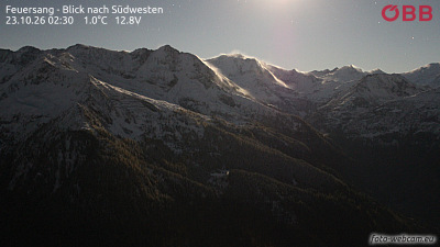
Webcams near Tischlerspitze



History around Tischlerspitze
Towns near Tischlerspitze
- Saalfelden am Steinernen Meer49 km away
- Villach69 km away
- Bad Reichenhall78 km away