Ammergauer Hochplatte
2.082 m6.831 pés
Montanha · Alpes de Ammergau · Alemanha
Hochplatte is a mountain of Bavaria, Germany. Standing at an elevation of 2082 meters, it is in the Ammergau Alps and is the highest point in the Ostallgäu district.
Da Wikipedia, CC BY-SA · Ler o artigo
No cume · previsão para 19:00
-3 °CPoucas nuvens · vento de 12 km/h de L
 Ver em 3D
Clima no cume de Ammergauer Hochplatte, 2.082 m
- 19:00-3 °CL 12 km/h–
- 22:00-4 °CSE 9 km/h–
- 1:00-5 °CSE 8 km/h–
- 4:00-5 °CSE 8 km/h–
- 7:00-5 °CSE 8 km/h–
- 10:000 °CNE 13 km/h–
- 13:002 °CNE 18 km/h–
- 16:000 °CNE 19 km/h–
| Dia | Céu | Máx. / mín. | Chuva | Vento até |
|---|---|---|---|---|
| sex., 30 de out. | Céu limpo | 2 °C / -5 °C | – | 20 km/h |
| sáb., 31 de out. | Céu limpo | 2 °C / -7 °C | – | 10 km/h |
| dom., 1 de nov. | Neve | -3 °C / -5 °C | 5 mm | 8 km/h |
| seg., 2 de nov. | Nublado | -3 °C / -6 °C | 0,4 mm | 13 km/h |
| ter., 3 de nov. | Nublado | -4 °C / -6 °C | 0,6 mm | 15 km/h |
| qua., 4 de nov. | Céu limpo | -1 °C / -8 °C | – | 11 km/h |
| qui., 5 de nov. | Nublado | -2 °C / -7 °C | – | 5 km/h |
Previsão: MET Norway (CC BY 4.0), atualizada às 18:20 GMT+1. Horários locais.
Ficha técnica
- Tipo
- Montanha
- Altitude acima do nível do mar
- 2.082 m (6.831 pés)
- Proeminência
- 968 m (3.176 pés)
- Isolamento
- a 4,3 km de um terreno mais alto
- Cordilheira
- Alpes de Ammergau
- País
- Alemanha
- Coordenadas
- 47.552°N 10.842°E
- Fonte
- Wikidata, CC0
Hochplatte
Mountain in Bavaria, Germany
Hochplatte is a mountain of Bavaria, Germany. Standing at an elevation of 2082 meters, it is in the Ammergau Alps and is the highest point in the Ostallgäu district. The mountain is also referred to as the Ammergauer Hochplatte to differentiate it from other mountains sharing the same name in the Northern Limestone Alps.
Da Wikipedia, CC BY-SA · Ler o artigo
Picos perto de Ammergauer Hochplatte
- Daniel2.340 m · a 14 kmNo mapa
- Gehrenspitze2.163 m · a 15 kmNo mapa
- Thaneller2.341 m · a 17 kmNo mapa
- Kellenspitze2.238 m · a 17 kmNo mapa
- Gimpel2.173 m · a 18 kmNo mapa
- Zugspitze2.962 m · a 18 kmNo mapa
- Rote Flüh2.108 m · a 18 kmNo mapa
- Schneefernerkopf2.874 m · a 19 kmNo mapa
- Hochwanner2.744 m · a 24 kmNo mapa
- Leilachspitze2.274 m · a 26 kmNo mapa
Os mais altos de Alpes de Ammergau
- Daniel2.340 mNo mapa
- Plattberg2.247 mNo mapa
- Kreuzspitze2.185 mNo mapa
- Geierköpfe2.161 mNo mapa
- Ammergauer Hochplatte2.082 mNo mapa
- Friederspitz2.049 mNo mapa
- Säuling2.047 mNo mapa
- Kramerspitz1.985 mNo mapa
- Kienjoch1.953 mNo mapa
Montanhas mais altas de Alemanha
- Zugspitze2.962 mNo mapa
- Hochwanner2.744 mNo mapa
- Dreitorspitze2.682 mNo mapa
- Hochkalter2.607 mNo mapa
- Biberkopf2.599 mNo mapa
- Grosser Hundstod2.594 mNo mapa
- Hochvogel2.592 mNo mapa
- Östliche Karwendelspitze2.538 mNo mapa
- Hocheisspitze2.523 mNo mapa
- Hoher Göll2.522 mNo mapa
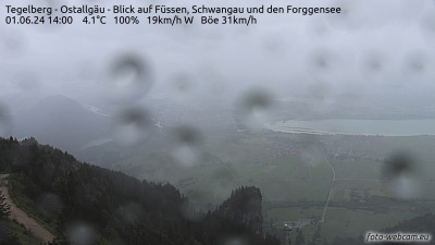
Webcams perto de Ammergauer Hochplatte



História ao redor de Ammergauer Hochplatte
Cidades perto de Ammergauer Hochplatte
- Füssena 11 km
- Garmisch-Partenkirchena 20 km
- Marktoberdorfa 30 km
- Telfsa 32 km
- Weilheima 40 km
- Kaufbeurena 40 km