Ammergauer Hochplatte
2082 m6831 ft
Montaña · Alpes de Ammergau · Alemania
Hochplatte is a mountain of Bavaria, Germany. Standing at an elevation of 2082 meters, it is in the Ammergau Alps and is the highest point in the Ostallgäu district.
De Wikipedia, CC BY-SA · Leer el artículo
En la cumbre · pronóstico para las 0:00
-1 °CNiebla · viento de 5 km/h del NE
 Verla en 3D
Clima en la cumbre de Ammergauer Hochplatte, 2082 m
- 0:00-1 °CNE 5 km/h–
- 3:00-1 °CE 7 km/h–
- 6:00-2 °CE 8 km/h–
- 9:00-1 °CE 10 km/h–
- 12:003 °CNE 17 km/h–
- 15:002 °CNE 17 km/h–
- 18:00-2 °CE 14 km/h–
- 21:00-4 °CE 10 km/h–
| Día | Cielo | Máx. / mín. | Lluvia | Viento hasta |
|---|---|---|---|---|
| Hoy | Despejado | 3 °C / -4 °C | – | 17 km/h |
| vie, 30 oct | Despejado | 2 °C / -5 °C | – | 20 km/h |
| sáb, 31 oct | Despejado | 2 °C / -7 °C | – | 10 km/h |
| dom, 1 nov | Nieve | -3 °C / -5 °C | 5 mm | 8 km/h |
| lun, 2 nov | Nublado | -3 °C / -6 °C | 0,4 mm | 13 km/h |
| mar, 3 nov | Nublado | -4 °C / -6 °C | 0,6 mm | 15 km/h |
| mié, 4 nov | Despejado | -1 °C / -8 °C | – | 11 km/h |
Pronóstico de MET Norway (CC BY 4.0), actualizado a las 18:20 CET. Horas locales.
Ficha técnica
- Tipo
- Montaña
- Altitud sobre el nivel del mar
- 2082 m (6831 ft)
- Prominencia
- 968 m (3176 ft)
- Aislamiento
- a 4,3 km de un terreno más alto
- Cordillera
- Alpes de Ammergau
- País
- Alemania
- Coordenadas
- 47.552°N 10.842°E
- Fuente
- Wikidata, CC0
Hochplatte
Mountain in Bavaria, Germany
Hochplatte is a mountain of Bavaria, Germany. Standing at an elevation of 2082 meters, it is in the Ammergau Alps and is the highest point in the Ostallgäu district. The mountain is also referred to as the Ammergauer Hochplatte to differentiate it from other mountains sharing the same name in the Northern Limestone Alps.
De Wikipedia, CC BY-SA · Leer el artículo
Picos cerca de Ammergauer Hochplatte
- Daniel2340 m · a 14 kmEn el mapa
- Gehrenspitze (Alpes de Allgäu)2163 m · a 15 kmEn el mapa
- Thaneller2341 m · a 17 kmEn el mapa
- Kellenspitze2238 m · a 17 kmEn el mapa
- Gimpel2173 m · a 18 kmEn el mapa
- Zugspitze2962 m · a 18 kmEn el mapa
- Rote Flüh2108 m · a 18 kmEn el mapa
- Schneefernerkopf2874 m · a 19 kmEn el mapa
- Hochwanner2744 m · a 24 kmEn el mapa
- Leilachspitze2274 m · a 26 kmEn el mapa
Los más altos de Alpes de Ammergau
- Daniel2340 mEn el mapa
- Plattberg2247 mEn el mapa
- Kreuzspitze2185 mEn el mapa
- Geierköpfe2161 mEn el mapa
- Ammergauer Hochplatte2082 mEn el mapa
- Friederspitz2049 mEn el mapa
- Säuling2047 mEn el mapa
- Kramerspitz1985 mEn el mapa
- Kienjoch1953 mEn el mapa
Montañas más altas de Alemania
- Zugspitze2962 mEn el mapa
- Hochwanner2744 mEn el mapa
- Dreitorspitze2682 mEn el mapa
- Hochkalter2607 mEn el mapa
- Biberkopf2599 mEn el mapa
- Großer Hundstod2594 mEn el mapa
- Hochvogel2592 mEn el mapa
- Östliche Karwendelspitze2538 mEn el mapa
- Hocheisspitze2523 mEn el mapa
- Hoher Göll2522 mEn el mapa
Cámaras web cerca de Ammergauer Hochplatte
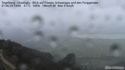



Historia alrededor de Ammergauer Hochplatte
Ciudades cerca de Ammergauer Hochplatte
- Füssena 11 km
- Garmisch-Partenkirchena 20 km
- Marktoberdorfa 30 km
- Telfsa 32 km
- Weilheima 40 km
- Kaufbeurena 40 km