ドイツの山
Ammergauer Hochplatte
2,082 m6,831 ft
山 · Ammergau Alps · ドイツ
Hochplatte is a mountain of Bavaria, Germany. Standing at an elevation of 2082 meters, it is in the Ammergau Alps and is the highest point in the Ostallgäu district.
出典: Wikipedia、CC BY-SA · 記事を読む
山頂 · 19:00 の予報
0 °C雪 · 北西の風 6 km/h
 3D で見る
Ammergauer Hochplatte 山頂の天気(2,082 m)
- 19:000 °C北西 6 km/h0.5 mm
- 22:00-1 °C北 4 km/h–
- 1:00-1 °C北東 4 km/h–
- 4:00-1 °C東 8 km/h–
- 7:00-2 °C東 8 km/h–
- 10:000 °C東 12 km/h–
- 13:003 °C北東 17 km/h–
- 16:001 °C北東 16 km/h–
| 日付 | 天気 | 最高 / 最低 | 雨 | 最大風速 |
|---|---|---|---|---|
| 10月29日(木) | 快晴 | 3 °C / -4 °C | – | 17 km/h |
| 10月30日(金) | 快晴 | 2 °C / -5 °C | – | 20 km/h |
| 10月31日(土) | 快晴 | 2 °C / -7 °C | – | 10 km/h |
| 11月1日(日) | 雪 | -3 °C / -5 °C | 5 mm | 8 km/h |
| 11月2日(月) | 曇り | -3 °C / -6 °C | 0.4 mm | 13 km/h |
| 11月3日(火) | 曇り | -4 °C / -6 °C | 0.6 mm | 15 km/h |
| 11月4日(水) | 快晴 | -1 °C / -8 °C | – | 11 km/h |
MET Norway(CC BY 4.0)による予報。14:17 GMT+1 更新。時刻は現地時間です。
基本データ
- 種類
- 山
- 標高
- 2,082 m (6,831 ft)
- プロミネンス
- 968 m (3,176 ft)
- 孤立度
- より高い地点まで 4.3 km
- 山脈
- Ammergau Alps
- 国
- ドイツ
- 座標
- 47.552°N 10.842°E
Hochplatte
Mountain in Bavaria, Germany
Hochplatte is a mountain of Bavaria, Germany. Standing at an elevation of 2082 meters, it is in the Ammergau Alps and is the highest point in the Ostallgäu district. The mountain is also referred to as the Ammergauer Hochplatte to differentiate it from other mountains sharing the same name in the Northern Limestone Alps.
出典: Wikipedia、CC BY-SA · 記事を読む
Ammergauer Hochplatte周辺の山
- Daniel2,340 m · 14 km先地図上
- Gehrenspitze2,163 m · 15 km先地図上
- Thaneller2,341 m · 17 km先地図上
- Kellenspitze2,238 m · 17 km先地図上
- Gimpel2,173 m · 18 km先地図上
- ツークシュピッツェ2,962 m · 18 km先地図上
- Rote Flüh2,108 m · 18 km先地図上
- Schneefernerkopf2,874 m · 19 km先地図上
- Hochwanner2,744 m · 24 km先地図上
- Leilachspitze2,274 m · 26 km先地図上
Ammergau Alpsの最高峰
- Daniel2,340 m地図上
- Plattberg2,247 m地図上
- Kreuzspitze2,185 m地図上
- Geierköpfe2,161 m地図上
- Ammergauer Hochplatte2,082 m地図上
- Friederspitz2,049 m地図上
- Säuling2,047 m地図上
- Kramerspitz1,985 m地図上
- Kienjoch1,953 m地図上
ドイツの高い山
- ツークシュピッツェ2,962 m地図上
- Hochwanner2,744 m地図上
- Dreitorspitze2,682 m地図上
- ホッホカルター2,607 m地図上
- Biberkopf2,599 m地図上
- Großer Hundstod2,594 m地図上
- Hochvogel2,592 m地図上
- Östliche Karwendelspitze2,538 m地図上
- Hocheisspitze2,523 m地図上
- Hoher Göll2,522 m地図上
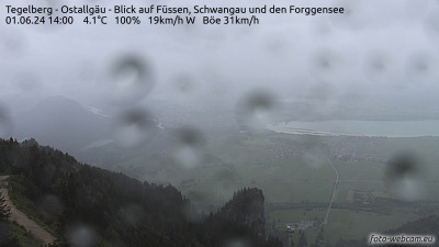
Ammergauer Hochplatte周辺のライブカメラ



Ammergauer Hochplatte周辺の歴史
Ammergauer Hochplatte周辺の町
- Füssen11 km先
- Garmisch-Partenkirchen20 km先
- Marktoberdorf30 km先
- Telfs32 km先
- Weilheim40 km先
- Kaufbeuren40 km先