Gokyo Ri
5357 m17.575 ft
Montaña · Himalaya · Nepal
Gokyo Peak is a 5,357 m (17,575 ft)-high peak in the Khumbu region of the Nepal Himalayas. It is located on the west side of the Ngozumpa glacier, which is the largest glacier in Nepal and reputed to be the largest in the whole Himalayas.
De Wikipedia, CC BY-SA · Leer el artículo
En la cumbre · pronóstico para las 0:45
-14 °CParcialmente nublado · viento de 8 km/h del N
 Verla en 3D
Clima en la cumbre de Gokyo Ri, 5357 m
- 0:45-14 °CN 8 km/h–
- 3:45-14 °CN 8 km/h–
- 6:45-13 °CN 8 km/h–
- 9:45-5 °CN 5 km/h–
- 12:45-3 °CS 10 km/h–
- 15:45-4 °CSE 6 km/h–
- 18:45-8 °CN 6 km/h–
- 21:45-8 °CN 5 km/h–
| Día | Cielo | Máx. / mín. | Lluvia | Viento hasta |
|---|---|---|---|---|
| Hoy | Parcialmente nublado | -3 °C / -14 °C | – | 10 km/h |
| jue, 29 oct | Nieve | -5 °C / -14 °C | 17,4 mm | 13 km/h |
| vie, 30 oct | Nieve fuerte | -5 °C / -6 °C | 107,5 mm | 9 km/h |
| sáb, 31 oct | Nieve | -3 °C / -11 °C | 8,7 mm | 6 km/h |
| dom, 1 nov | Mayormente despejado | -5 °C / -13 °C | – | 10 km/h |
| lun, 2 nov | Nieve débil | -4 °C / -13 °C | 1 mm | 8 km/h |
| mar, 3 nov | Despejado | -6 °C / -15 °C | 0,2 mm | 10 km/h |
Pronóstico de MET Norway (CC BY 4.0), actualizado a las 23:02 GMT+5:45. Horas locales.
Ficha técnica
- Tipo
- Montaña
- Altitud sobre el nivel del mar
- 5357 m (17.575 ft)
- Cordillera
- Himalaya
- País
- Nepal
- Coordenadas
- 27.961°N 86.683°E
- Fuente
- Wikidata, CC0
Gokyo Ri
Mountain in Nepal
Gokyo Peak is a 5,357 m (17,575 ft)-high peak in the Khumbu region of the Nepal Himalayas. It is located on the west side of the Ngozumpa glacier, which is the largest glacier in Nepal and reputed to be the largest in the whole Himalayas. Gokyo, at the base of Gokyo Ri, is a small village with several houses and lodges, and is one of the highest settlements in the world.
De Wikipedia, CC BY-SA · Leer el artículo
Picos cerca de Gokyo Ri
- Pharilapcha6017 m · a 3,6 kmEn el mapa
- Nirekha6169 m · a 8 kmEn el mapa
- Cholatse6440 m · a 9,3 kmEn el mapa
- Lobuche6145 m · a 10 kmEn el mapa
- Hungchi7029 m · a 11 kmEn el mapa
- Taboche6501 m · a 12 kmEn el mapa
- Mount Khumbila5761 m · a 13 kmEn el mapa
- Nangpai Gosum7350 m · a 14 kmEn el mapa
- Jobo Rinjang6778 m · a 15 kmEn el mapa
- Kala Patthar5645 m · a 15 kmEn el mapa
Los más altos de Himalaya
- Kanchenjunga8586 mEn el mapa
- Dhaulagiri8167 mEn el mapa
- Nanga Parbat8126 mEn el mapa
- Nanda Devi7816 mEn el mapa
- Jannu7711 mEn el mapa
- Gurla Mandhata7694 mEn el mapa
- Silberzacken7597 mEn el mapa
- Gangkhar Puensum7570 mEn el mapa
- Gokyo Ri5357 mEn el mapa
Montañas más altas de Nepal
- Everest8849 mEn el mapa
- Kanchenjunga8586 mEn el mapa
- Lhotse8516 mEn el mapa
- Makalu8485 mEn el mapa
- Cho Oyu8188 mEn el mapa
- Dhaulagiri8167 mEn el mapa
- Manaslu8163 mEn el mapa
- Annapurna I8091 mEn el mapa
- Gyachung Kang7952 mEn el mapa
- Annapurna II7937 mEn el mapa
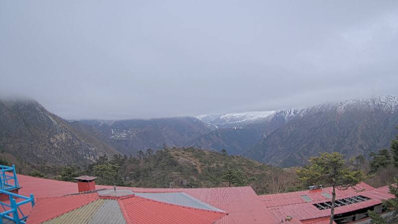
Cámaras web cerca de Gokyo Ri
Historia alrededor de Gokyo Ri
Ciudades cerca de Gokyo Ri
- Chari̇̄koṭa 70 km