Gokyo Ri
5,357 m17,575 ft
Mountain · Himalayas · Nepal
Gokyo Peak is a 5,357 m (17,575 ft)-high peak in the Khumbu region of the Nepal Himalayas. It is located on the west side of the Ngozumpa glacier, which is the largest glacier in Nepal and reputed to be the largest in the whole Himalayas.
From Wikipedia, CC BY-SA · Read the article
At the summit · forecast for 6:45 AM
-15 °CClear · wind 10 km/h from the N
 See it in 3D
Weather at the summit of Gokyo Ri, 5,357 m
- 6:45 AM-15 °CN 10 km/h–
- 9:45 AM-6 °CSW 9 km/h–
- 12:45 PM-4 °CS 12 km/h–
- 3:45 PM-5 °CS 10 km/h–
- 6:45 PM-11 °CN 6 km/h–
- 9:45 PM-12 °CN 8 km/h–
- 12:45 AM-13 °CN 9 km/h–
- 3:45 AM-15 °CN 8 km/h–
| Day | Sky | High / low | Rain | Wind up to |
|---|---|---|---|---|
| Today | Clear | -4 °C / -15 °C | – | 12 km/h |
| Wed, Oct 28 | Cloudy | -3 °C / -15 °C | – | 10 km/h |
| Thu, Oct 29 | Snow | -4 °C / -11 °C | 20.5 mm | 9 km/h |
| Fri, Oct 30 | Heavy snow | -5 °C / -6 °C | 80.9 mm | 5 km/h |
| Sat, Oct 31 | Snow | -3 °C / -11 °C | 5.2 mm | 7 km/h |
| Sun, Nov 1 | Clear | -5 °C / -13 °C | 0.2 mm | 9 km/h |
| Mon, Nov 2 | Light snow | -5 °C / -13 °C | 1.3 mm | 8 km/h |
Forecast by MET Norway (CC BY 4.0), updated 05:04 AM GMT+5:45. Times are local.
Facts
- What it is
- Mountain
- Height above sea level
- 5,357 m (17,575 ft)
- Range
- Himalayas
- Country
- Nepal
- Coordinates
- 27.961°N 86.683°E
- Source
- Wikidata, CC0
Gokyo Ri
Mountain in Nepal
Gokyo Peak is a 5,357 m (17,575 ft)-high peak in the Khumbu region of the Nepal Himalayas. It is located on the west side of the Ngozumpa glacier, which is the largest glacier in Nepal and reputed to be the largest in the whole Himalayas. Gokyo, at the base of Gokyo Ri, is a small village with several houses and lodges, and is one of the highest settlements in the world.
From Wikipedia, CC BY-SA · Read the article
Peaks near Gokyo Ri
- Pharilapcha6,017 m · 3.6 km awayOn the map
- Nirekha6,169 m · 8 km awayOn the map
- Cholatse6,440 m · 9.3 km awayOn the map
- Lobuche6,145 m · 10 km awayOn the map
- Hungchi7,029 m · 11 km awayOn the map
- Taboche6,501 m · 12 km awayOn the map
- Mount Khumbila5,761 m · 13 km awayOn the map
- Nangpai Gosum7,350 m · 14 km awayOn the map
- Jobo Rinjang6,778 m · 15 km awayOn the map
- Kala Patthar5,645 m · 15 km awayOn the map
Highest in the Himalayas
- Kanchenjunga8,586 mOn the map
- Dhaulagiri8,167 mOn the map
- Nanga Parbat8,126 mOn the map
- Nanda Devi7,816 mOn the map
- Jannu7,711 mOn the map
- Gurla Mandhata7,694 mOn the map
- Silberzacken7,597 mOn the map
- Gangkhar Puensum7,570 mOn the map
- Gokyo Ri5,357 mOn the map
Highest mountains in Nepal
- Mount Everest8,849 mOn the map
- Kanchenjunga8,586 mOn the map
- Lhotse8,516 mOn the map
- Makalu8,485 mOn the map
- Cho Oyu8,188 mOn the map
- Dhaulagiri8,167 mOn the map
- Manaslu8,163 mOn the map
- Annapurna I8,091 mOn the map
- Gyachung Kang7,952 mOn the map
- Annapurna II7,937 mOn the map
Webcams near Gokyo Ri
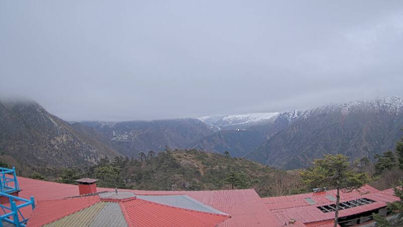
History around Gokyo Ri
Towns near Gokyo Ri
- Chari̇̄koṭ70 km away