Baruntse
7,129 m23,389 ft
Mountain · Nepal
Baruntse is a mountain in the Khumbu region of eastern Nepal, crowned by four peaks and bounded on the south by the Hunku Glacier, on the east by the Barun Glacier, and on the northwest by the Imja Glacier.
From Wikipedia, CC BY-SA · Read the article
At the summit · forecast for 5:45 AM
-27 °CClear · wind 7 km/h from the NW
 See it in 3D
Weather at the summit of Baruntse, 7,129 m
- 5:45 AM-27 °CNW 7 km/h–
- 8:45 AM-21 °CNW 7 km/h–
- 11:45 AM-17 °CW 9 km/h–
- 2:45 PM-16 °CW 8 km/h–
- 5:45 PM-22 °CNW 6 km/h–
- 8:45 PM-23 °CNW 5 km/h–
- 11:45 PM-25 °CNW 7 km/h–
- 2:45 AM-26 °CNW 7 km/h–
| Day | Sky | High / low | Rain | Wind up to |
|---|---|---|---|---|
| Today | Clear | -16 °C / -27 °C | – | 9 km/h |
| Wed, Oct 28 | Cloudy | -15 °C / -27 °C | – | 8 km/h |
| Thu, Oct 29 | Snow | -14 °C / -21 °C | 13.6 mm | 6 km/h |
| Fri, Oct 30 | Heavy snow | -14 °C / -15 °C | 78.4 mm | 4 km/h |
| Sat, Oct 31 | Partly cloudy | -13 °C / -18 °C | 11.4 mm | 6 km/h |
| Sun, Nov 1 | Mostly clear | -14 °C / -22 °C | 0.2 mm | 4 km/h |
| Mon, Nov 2 | Light snow | -17 °C / -27 °C | 1.8 mm | 5 km/h |
Forecast by MET Norway (CC BY 4.0), updated 05:04 AM GMT+5:45. Times are local.
Facts
- What it is
- Mountain
- Height above sea level
- 7,129 m (23,389 ft)
- Prominence
- 979 m (3,212 ft)
- Country
- Nepal
- Coordinates
- 27.883°N 86.983°E
- Source
- Wikidata, CC0
Baruntse
Mountain in Nepal
Baruntse is a mountain in the Khumbu region of eastern Nepal, crowned by four peaks and bounded on the south by the Hunku Glacier, on the east by the Barun Glacier, and on the northwest by the Imja Glacier. It is considered as one of the best preparation peaks in the Himalayas for climbers readying themselves for eight-thousanders, however the mountain has a low success rate due to its technical difficulties, steep s…
From Wikipedia, CC BY-SA · Read the article
Peaks near Baruntse
- Num Ri6,677 m · 1.8 km awayOn the map
- Cho Polu6,735 m · 4 km awayOn the map
- Imja Tse6,189 m · 6.2 km awayOn the map
- Lhotse Middle8,410 m · 8.7 km awayOn the map
- Lhotse Shar8,383 m · 9.2 km awayOn the map
- Lhotse8,516 m · 10 km awayOn the map
- Makalu8,485 m · 10 km awayOn the map
- Ombigaichan6,340 m · 10 km awayOn the map
- Hillary Peak7,681 m · 11 km awayOn the map
- Chamlang7,319 m · 12 km awayOn the map
Highest mountains in Nepal
- Mount Everest8,849 mOn the map
- Kanchenjunga8,586 mOn the map
- Lhotse8,516 mOn the map
- Makalu8,485 mOn the map
- Cho Oyu8,188 mOn the map
- Dhaulagiri8,167 mOn the map
- Manaslu8,163 mOn the map
- Annapurna I8,091 mOn the map
- Gyachung Kang7,952 mOn the map
- Annapurna II7,937 mOn the map
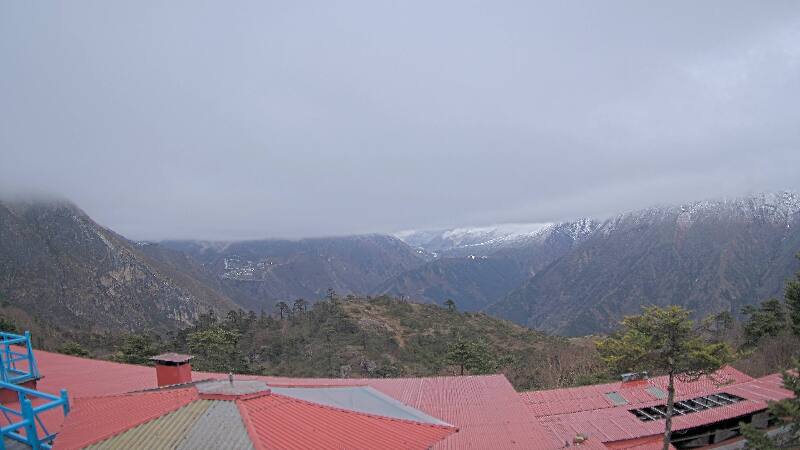
Webcams near Baruntse
History around Baruntse
- Twelve people are killed in an avalanche on Mount Everest2014
- 1996 Everest disaster: A sudden storm engulfs Mount Everest with several climbing teams high on the mountain, leaving eight people dead1996
- Mt Everest & Border Regions1959
- Lionel Terray and Jean Couzy become the first people to reach the summit of Makalu, the fifth-highest mountain in the world1955
Towns near Baruntse
- Khā̃dbāri̇̄61 km away