Rugard
91 m299 ft
Hill · Germany
The Rugard, at 91 m above sea level (NN), is the highest elevation in the central region of the German Baltic Sea island of Rügen. This push end moraine was formed in the last ice age and lies on the northeastern perimeter of the town of Bergen auf Rügen.
From Wikipedia, CC BY-SA · Read the article
At the summit · forecast for 1:00 AM
8 °CCloudy · wind 17 km/h from the S
 See it in 3D
Weather at the summit of Rugard, 91 m
- 1:00 AM8 °CS 17 km/h–
- 4:00 AM9 °CS 17 km/h–
- 7:00 AM9 °CS 21 km/h–
- 10:00 AM9 °CS 21 km/h–
- 1:00 PM11 °CS 17 km/h–
- 4:00 PM11 °CS 20 km/h–
- 7:00 PM11 °CS 18 km/h–
- 10:00 PM10 °CS 19 km/h–
| Day | Sky | High / low | Rain | Wind up to |
|---|---|---|---|---|
| Today | Cloudy | 11 °C / 8 °C | – | 22 km/h |
| Wed, Oct 28 | Cloudy | 13 °C / 8 °C | – | 17 km/h |
| Thu, Oct 29 | Cloudy | 13 °C / 8 °C | – | 13 km/h |
| Fri, Oct 30 | Cloudy | 12 °C / 9 °C | – | 11 km/h |
| Sat, Oct 31 | Cloudy | 12 °C / 9 °C | – | 9 km/h |
| Sun, Nov 1 | Cloudy | 11 °C / 8 °C | – | 13 km/h |
| Mon, Nov 2 | Cloudy | 11 °C / 8 °C | – | 17 km/h |
Forecast by MET Norway (CC BY 4.0), updated 12:31 AM GMT+1. Times are local.
Facts
- What it is
- Hill
- Height above sea level
- 91 m (299 ft)
- Country
- Germany
- Coordinates
- 54.418°N 13.447°E
- Source
- Wikidata, CC0
Rugard
The Rugard, at 91 m above sea level (NN), is the highest elevation in the central region of the German Baltic Sea island of Rügen. This push end moraine was formed in the last ice age and lies on the northeastern perimeter of the town of Bergen auf Rügen. There was probably a castle here from the 9th century to the year 1325 A.D., in which princes of the Slavic Rani tribe resided.
From Wikipedia, CC BY-SA · Read the article
Peaks near Rugard
- Piekberg161 m · 19 km awayOn the map
- Königsstuhl118 m · 22 km awayOn the map
- Streckelsberg58 m · 55 km awayOn the map
- Schlossberg24 m · 7.7 km awayOn the map
- Baken-Berg66 m · 8.1 km awayOn the map
- WaldhalleHill · 15 km awayOn the map
- Kleiner KönigsstuhlMountain · 18 km awayOn the map
- Zickerberg66 m · 19 km awayOn the map
- HerthaburgHill · 21 km awayOn the map
- Lotsenberg36 m · 24 km awayOn the map
Highest mountains in Germany
- Zugspitze2,962 mOn the map
- Hochwanner2,744 mOn the map
- Dreitorspitze2,682 mOn the map
- Hochkalter2,607 mOn the map
- Biberkopf2,599 mOn the map
- Großer Hundstod2,594 mOn the map
- Hochvogel2,592 mOn the map
- Östliche Karwendelspitze2,538 mOn the map
- Hocheisspitze2,523 mOn the map
- Hoher Göll2,522 mOn the map
Webcams near Rugard

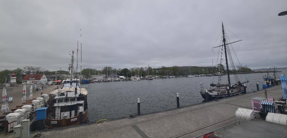


History around Rugard
Towns near Rugard
- Stralsund27 km away
- Universitäts- und Hansestadt Greifswald37 km away
- Ribnitz-Damgarten67 km away
- Świnoujście77 km away